Oude Doelenstraat is a short, busy shopping street in Amsterdam’s medieval core, running east from the Oudezijds Voorburgwal to the Oudezijds Achterburgwal. It is the middle link in the chain that carries walkers from Dam Square along Damstraat and on into Oude Hoogstraat toward Nieuwmarkt, and it takes its name from the city’s first civic militia shooting range.
Where Oude Doelenstraat actually is
The street continues the line of Damstraat, which begins at Dam Square and ends at the Oudezijds Voorburgwal. Oude Doelenstraat picks up on the far side of that canal and runs one block east to the Oudezijds Achterburgwal, after which the same route becomes Oude Hoogstraat and then Nieuwe Hoogstraat on the way to the Sint Antoniesbreestraat.
This is not a detour or a hidden lane. Since the Middle Ages the corridor has formed part of Amsterdam’s principal east–west axis, leading from the dam in the Amstel out to the Sint Antoniesdijk, which was then the city’s eastern boundary. Anyone following a map east from Dam Square is routed straight down it.
One practical consequence: the street sits inside De Wallen. Crossing the first canal east of Dam Square puts you in the red light district, and the bridge over the Oudezijds Voorburgwal between Damstraat and Oude Doelenstraat — the Varkenssluis — is the recognised dividing line between the raucous northern half of the district and its far quieter southern half.
What the name means
“Oude” means old, and “Doelen” was the Dutch term for a shooting range where the schutterij, the civic militia, drilled with bow and crossbow. The street is named after a specific place: the Oude Doelen, the first such range the city owned.
- A building dating from 1382 hosted the local militia’s practice sessions.
- The wider grounds, recorded from around 1417, occupied the block between the Oudezijds Voorburgwal and the Oudezijds Achterburgwal, bounded by the Stoofsteeg and the Prinsenhofssteeg.
- The range lost its function roughly a century later, and the site was sold for building in 1516–1517 once the archers had moved to a location south of the Spui.
- A street was cut across the former grounds, and the old building was demolished in 1542.
- Three replacement ranges were built, including the Kloveniersdoelen, which is where nearby Nieuwe Doelenstraat gets its name.
A small courtyard known as the Doelenhofje survived on the southern edge of the old grounds until 1920, entered through the Leeuwenpoortje in the Prinsenhofsteeg, which the draughtsman Gerrit Lamberts recorded in 1816.
A shopping street rebuilt by traffic
Do not come here expecting a preserved row of Golden Age canal houses. Because the street lay on the main through-route, it was targeted by the nineteenth-century traffic breakthrough that widened the corridor from Dam Square eastward. The entire north side of Oude Doelenstraat was demolished in 1868, and a council decision of 30 September 1868 gave the newly widened western section the name Damstraat.
Oude Doelenstraat was the only part of the breakthrough to keep its historic name. In 1890–92 it was paved together with Damstraat and the Hoogstraten to become the first asphalted road in Amsterdam. The result today is a nineteenth- and twentieth-century commercial streetscape on a medieval street plan.
The retail history is documented in unusual detail. Number 11 alone has housed a shoe shop from 1869, a carpet dealer from 1881, the children’s-wear store Maison Bébé from 1890, a furniture shop, a fabric shop, a household-goods firm, a bicycle dealer, and finally a gaming arcade whose last operator closed in 2008. A Coffee Company café has occupied the premises since 2009.
Commercially, the street is grouped with Damstraat and Oude Hoogstraat as the “Damstraatjes,” a small retail zone of cafés, takeaways, souvenir shops and services rather than a destination shopping district.
The Doelen hotel is on a different street
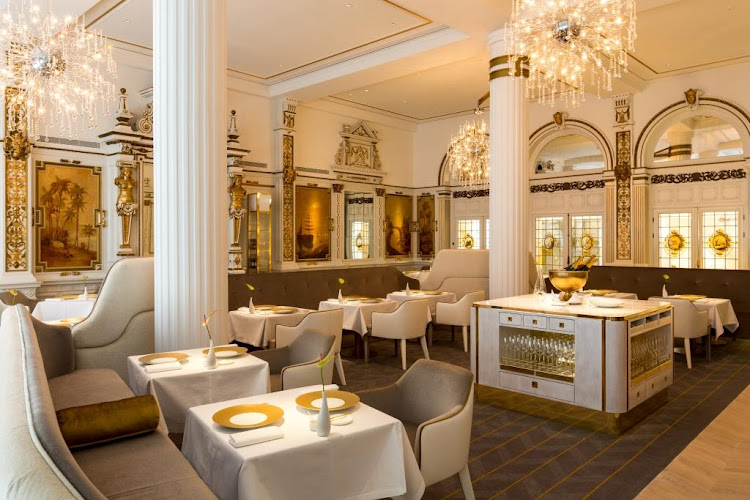
Visitors often connect Oude Doelenstraat with the grand Doelen hotel, but the two are separate. The hotel’s entrance is at Nieuwe Doelenstraat 24, on the Binnen-Amstel near the southern end of the Kloveniersburgwal, several minutes’ walk south.
- H.F. Hahn bought the earlier Brack’s Doelen Hotel in 1882, anticipating crowds for the 1883 World Exhibition, and rebuilt it at speed.
- The property was fully renovated and reopened in 2016 as NH Collection Doelen.
- Since 2023 it has operated as the Tivoli Doelen Amsterdam Hotel under Tivoli Hotels & Resorts, part of Minor Hotels.
Both street names trace back to the same militia institution, which is the likely source of the confusion: Oude Doelenstraat recalls the first range, Nieuwe Doelenstraat the later Kloveniersdoelen.
Visiting: what to expect on the ground
- Crowding. This is one of the densest pedestrian funnels in the centre; early morning is the only reliably calm window.
- Traffic rules. Since September 2024 the city has blocked motor traffic from the Wallen area from reaching Dam Square via Damstraat, with exemptions for emergency services, cyclists, mopeds and timed loading. Do not plan to drive here.
- Family routing. Travellers who prefer to avoid red-light windows with children can reach the eastern centre instead via Rokin, Amstelstraat and Waterlooplein, adding roughly six minutes.
- Nearby on foot. Dam Square with the Royal Palace and the National Monument lie a minute west; the Oude Kerk, Nieuwmarkt and the Waag are a short walk north and east.
Frequently asked questions
Does Oude Doelenstraat start at Dam Square?
No. Damstraat runs from Dam Square to the Oudezijds Voorburgwal, and Oude Doelenstraat continues from that canal east to the Oudezijds Achterburgwal. The two streets form one continuous route, so walkers pass from one into the other without an obvious break.
What does "Doelen" mean in Amsterdam street names?
A doelen was a shooting range used by the schutterij, the civic militia. Oude Doelenstraat is named after the Oude Doelen, the city’s first range, whose 1382 practice building stood on this block. Nieuwe Doelenstraat is named after the later Kloveniersdoelen.
Is the Doelen hotel located on Oude Doelenstraat?
No. The hotel entrance is at Nieuwe Doelenstraat 24, by the Binnen-Amstel. It traded as NH Collection Doelen after a 2016 renovation and has been the Tivoli Doelen Amsterdam Hotel since 2023.
Is Oude Doelenstraat in the red light district?
Yes. It sits inside De Wallen, immediately east of the Oudezijds Voorburgwal. The Varkenssluis bridge beside it marks the boundary between the busy northern part of the district and the calmer southern stretch.
Are there historic Golden Age houses to see on the street?
Not on the north side. It was demolished in 1868 to widen the street for through traffic, and the street was among the first in Amsterdam to be asphalted in 1890-92. The surviving fabric is mainly nineteenth- and twentieth-century commercial building.